I zoomed in and saw a guy on the slopes skiing, is that you? :wink_smile:
Those terrain model at the background, I remember Prof Neil mentioned sth about modeling in PDMS before. Can you provide us a little more insights how it is done? Laser scan data converted into Polygon/Polyhedrons? Did it add too much overhead to opening PDMS model?
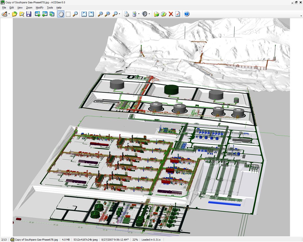
Hi De & Amit;
Thats a very huge work between 4 companies and many branches for each comapny in the world;
as you can see it divided according to scope of work for each company.
the scope of work for flare area established by TOYO/JAPAN.
I have checked this model & asked from originator of this & he mentioned to the following links; http://www.plantcon.dk/uk/sitem.htm
look to this link; I will explain more & take some another sanpshot for model a.s.a.p.
but de.. i am sure that we have not use from laser method in this project.
Name of project: Southpars gas fileld phase 6-7-8
Location: Iran-Assalouieh
Comapnies:Toyo-JGC_DEALEM-IDRO
I see, plantcon wrote some program to import survey data into PDMS model. But if this is done by Toyo, it will be done in PDS.
We are already kicking some behinds here on our project. This one I am on is quite large too, with 10 international contractors. The client commented that our 60% model review is like 70%, so they want to move the 90% client review 2 months early. And we are one of the two companies out of 10 using PDMS on this job.
Can we jump to the conclusion that PDMS is better than PDS?
That's a bird eye view. Can anybody send me details that PDMS has been used right from the design stage upto commercial operation ( or contd...) of 500MWe and above Nuclear Power Plant using the all the softwares and technologies provided by AVEVA. What should be the type and capacity of infrastructure one has to develop including manpower strength.